Catalog Archive
Auction 120, Lot 326

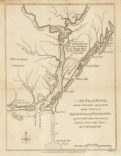
"Cape Fear River, with the Counties Adjacent, and the Towns of Brunswick and Wilmington, against which Lord Cornwallis detached a Part of his Army, the 17th of January last.", Lodge, John

Subject: North Carolina

Period: 1781 (dated)

Publication: Political Magazine

Color: Black & White

Size:
7 x 9.5 inches
17.8 x 24.1 cm
Download High Resolution Image
(or just click on image to launch the Zoom viewer)

This interesting and scarce map depicts the Cape Fear River vicinity near the close of the Revolutionary War. Wilmington was captured by the British in 1781 and plantations in the Cape Fear area were ransacked. The map shows numerous locations including Mount Misery, Wilmington, Brunswick and Lockwoods Folly with notations of their distance from Charlestown, from which General Cornwallis launched his attack on the region. Fort Johnson, which had been destroyed at the outbreak of the war is shown.

References: Jolly #POL-22; Sellers & Van Ee #1512.

Condition: B+

A couple light stains at the top of the map.

Estimate: $275 - $350

Sold for: $210

Closed on 7/18/2007

Archived