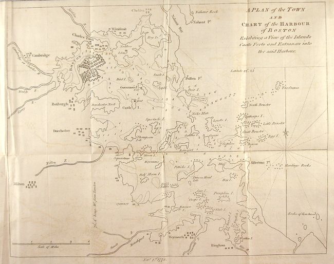
Subject: Boston, Massachusetts
Period: 1775 (dated)
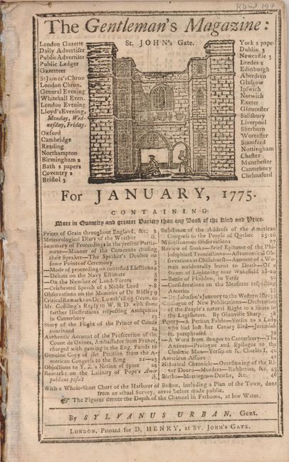
Publication: Gentlemen's Magazine
Color: Black & White
Size:
13 x 10.4 inches
33 x 26.4 cm
This attractive copper engraved map of the greater Boston area was issued just prior to the first hostilities of the American Revolution. The map focuses on the islands in the harbor with soundings, hazards and shipping lanes carefully delineated. Among the towns located on the map are Chelsea, Cambridge, Dorchester, Milton, and Weymouth. Several maps of Boston and the surrounding area appeared in English magazines during 1774-75 as Boston became the hot spot of resentment against British taxation and rule. This map was issued just a few months before the defining conflicts at Lexington and Concord. The map is bound in the original and complete Gentlemen's Magazine of January 1775, as issued.
References: Jolly GENT-232.
Condition: B
A little light offsetting and a short binding tear restricted to blank margin, closed on verso with archival tape.