Catalog Archive
Auction 120, Lot 301

"Map of Maine Constructed from the most Correct Surveys With Sectional Distances and Elevations or Level, of the St. Croix River from Calais Bridge. Deduced from the States Survey, Made by W. Anson, Civil Engineer, In 1836.", Anson, W.
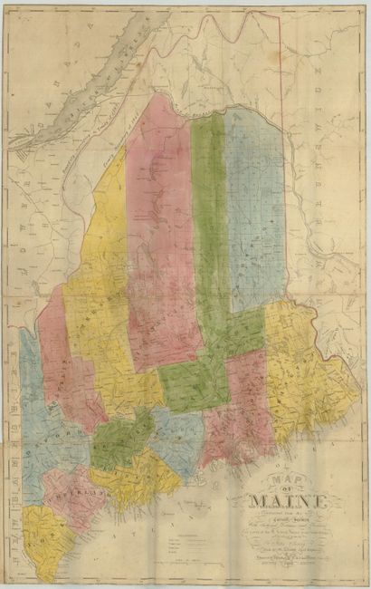
Subject: Maine

Period: 1843 (dated)

Publication:

Color: Hand Color

Size:
14 x 23 inches
35.6 x 58.4 cm
Download High Resolution Image
(or just click on image to launch the Zoom viewer)

This is a most scarce map of Maine that was "Engraved & Published by S.H. Colesworthy, Portland. 1843." This is actually the first edition of this map despite the "Revised 1843 Edition" below the title, that refers to Anson's 'official' map of 1839, based on his 1836 surveys. Anson considered this map a revision of the earlier map of the state. This is one of the earliest separately published maps of Maine following the treaty of 1842 which settled the border with Canada. From the binding trim it is unclear if this was in a book or in pocket map format. Not in Phillips Maps of America. Scarce.

References: Rumsey #2964.001.

Condition: B

Folding as issued with a light wear at some folds. Full wash color. Close trimmed to border, as issued.

Estimate: $500 - $700

Sold for: $700

Closed on 7/18/2007

Archived