Subject: Maine
Period: 1785 (dated)
Publication: Impartial History of England ... to the Year 1786
Color: Black & White
Size:
15 x 14.5 inches
38.1 x 36.8 cm
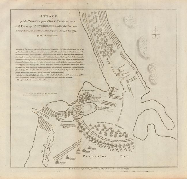
An interesting and uncommon map detailing the movement of the British and American ships during the failed Penobscot Expedition of 1779. The American Continental Congress heard that the British were establishing an outpost in Penobscot Bay (in present-day Castine) in order to attack American interests in New England, so they sent up over 40 ships and 1000 militia to rout them. Unfortunately, the commander of the expedition, Commodore Dudley Saltonstall, proved incompetent, retreating and burning his own ships, while the British force of only 600-800 were able to defeat them with only 13 casualties on the British side and 473 casualties on the American side. It was America's worst naval defeat until Pearl Harbor. The map shows multitudes of ships, many named, and a lengthy description of the battle under the title.
References: Nebenzahl (Biblio) #40.
Condition: B
A few spots of foxing and some light creases, still good for a map of this type.