Subject: New Orleans, Louisiana
Period: 1764 (published)
Publication: Le Petite Atlas Maritime
Color: Hand Color
Size:
11.5 x 8.3 inches
29.2 x 21.1 cm
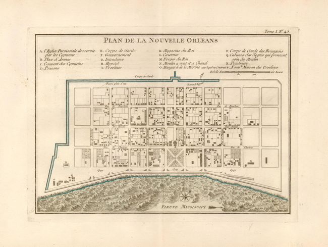
Attractive plan of the city of New Orleans details the city center, including Bourbon Street, with individual buildings depicted and keyed to a list under the title. Locates the quay along the Mississippi River, the canal, government buildings, church, prison, hospital, monastery, army & navy quarters. Bellin's plan was first issued in Charlevoix's History and General Description of New France in 1742, with later versions such as this published in several publications. The plan became the standard map of New Orleans throughout the eighteenth century.
References: cf Lemmon, Magill & Wiese #171.
Condition: A+
Nice original color delineating the Mississippi River and canal, lightly toned margins, not affecting map.