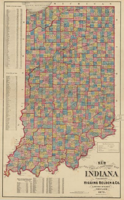
Subject: Indiana
Period: 1875 (dated)
Publication:
Color: Hand Color
Size:
15.8 x 26.3 inches
40.1 x 66.8 cm
This double-page map is beautifully executed by the uncommon publisher Higgins Belden of Chicago. It was likely published with one of their state atlases. The map has remarkable detail throughout including small villages, post offices and all townships. Tables at left give the comparative population by county based on the 1860 and 1870 census. Another table gives the latest population figures for cities and towns. Engraved by D.L. Bourquin of Chicago. Higgins is more often associated with Warner or Warner & Beers, the association of Higgins and Belden is rarely seen.
References:
Condition: B+
Just a couple light spots in blank area outside of map image. Bright original coloring and fine impression.