Subject: Hawaii
Period: 1885 (dated)
Publication:
Color: Printed Color
Size:
35.5 x 29 inches
90.2 x 73.7 cm
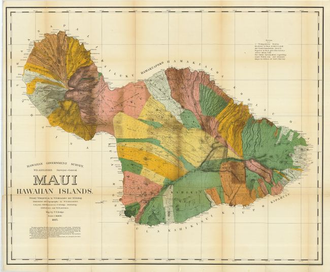
This is the first edition of this large and handsome map depicting Maui in great detail shortly after its annexation by the United States. Maui was the main island of the "county group" with a population approaching 40,000. Survey work during the previous decade had resulted in preparation of good maps, but there remained the problem of laying out the lands for settlement under existing land laws. This map delineates lands for sale, awarded lands, and much more. Made under the direction of W.D. Alexander, Surveyor General. Map drawn by F.S. Dodge, with topography by Alexander, Dodge, C.J. Lyons, M.D. Monsarrat, S.E. Bishop, E.D. Baldwin, and W.R. Lawrence.
References:
Condition: B
Fine impression and color with full margins. Some toning at folds with a few fold splits reinforced on verso with archival tape.