Subject: Dakota Territory
Period: 1879-83 (dated)
Publication:
Color:
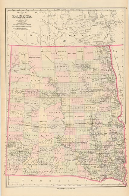
Pair of maps of the large territory of Dakota. The first is O.W. Gray's double sheet map of the territory, here filled with organized counties. This is the large version produced in 1883. Hand colored, 16.5 x 24".
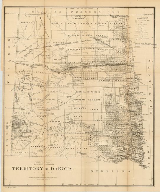
The second map was produced in 1879 by the General Land Office. This large county map shows in great detail the extent of public surveys in the territory, with Bismarck noted as the capital. Filled with details, it includes the location of military and Indian reservations, railroads, the extent of the Northern Pacific Railroad (both the proposed and amended routes), land grants, cities, towns, county seats, and more. The Cheyenne Agency is located a little north of Ft. Sully. Economic development is still largely limited to the eastern portion. Drawn by C. Roeser, Principal Draughtsman. Uncolored, folding as issued 17.5 x 21".
References:
Condition:
The first is very good, the second is good+.