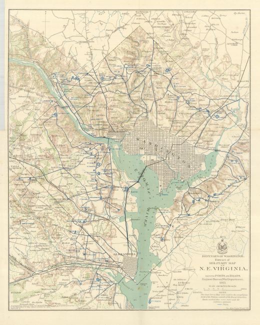
Subject: District of Columbia
Period: 1865 (dated)
Publication: Official Atlas of the Civil War
Color: Printed Color
Size:
13 x 16.3 inches
33 x 41.4 cm
This is a most interesting map that details the various defenses poised to defend Washington from the Confederate Army during the Civil War. Beautifully engraved, the map extends to include Alexandria, Falls Church, Silver Spring, and Bladensburg. With remarkable detail, the map locates forts, schools, mills, railroads, fortifications, and much more. There are scores of individual homes and farms located with the owner's name. Washington is shown in street grid plan format. Fine detail of watershed and topography. The map was published to accompany the "report of Brig. Gen. Richard Delafield…dated October 30, 1865." Dated 1865, but published 1891-95.
References:
Condition: A+
A clean and bright example. With very short marginal tear at binding trim.