Subject: San Francisco, California
Period: 1853-1869 (dated)
Publication:
Color: Black & White
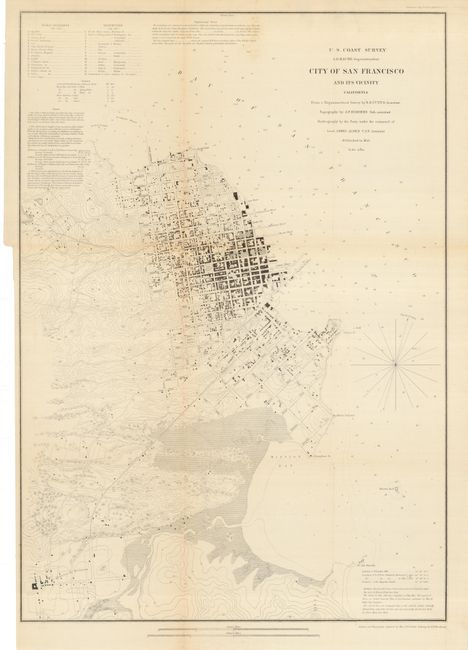
The first (17.7 x 25.3") is a terrific city plan that carries fine detail of buildings, streets and roads, terrain through contour lines, etc. It covers the region from North Point to Mission de Delores and to Point San Quentin. Streets are clearly laid out and named with detail down to individual buildings. Extant buildings are shown in black along the streets in both San Francisco and Mission de Dolores, which are connected by Plank Road. Numbers keyed to an inset indicate sixteen public buildings and fifteen reservoirs.
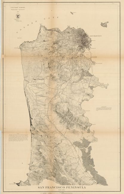
The second (17.5 x 28.1") is a very detailed map that shows the peninsula from the location of today's San Francisco International Airport, here labeled Milbrae Station, and up to the city of San Francisco. The San Francisco and San Jose Railroad is shown leading into the city. The Cliff House at Pt. Lobos, the Presidio, Mission de Dolores, the large Green House Race Course, and many other interesting points of interest are noted. There is excellent detail of the city's street layout and the islands of Alcatraz and Yorba Buena detailed. Many coastal features are listed, including Point San Pedro, Fort Point, Black Point, Point San Quentin, Hunter's Point, Sierra Point and Point San Bruno. This very nice pair of maps of San Francisco feature remarkable detail for the period.
References:
Condition: B
Both are pressed and backed with archival tissue. The first with just a hint of fold toning, still very good. The second has a small notch out of map at neatline with a paper repair, and a 1" tear in the lower right corner, just entering border.