Subject: California
Period: 1850 (dated)
Publication: Sen. Doc. 110, 32nd. Cong., 1st Sess.
Color: Black & White
Size:
18.3 x 14.8 inches
46.5 x 37.6 cm
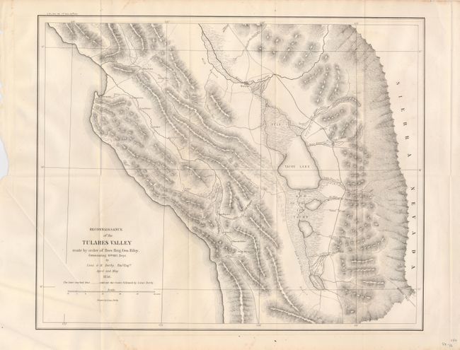
This interesting map of the area south of the San Joaquin River from the Pacific Ocean to the foothills of the Sierra Nevada Mountains was not published until 1852. The Road to Los Angeles runs through the center of the map. This road offers two routes to LA on either side of Tache Lake with the easternmost route running along the base of the Sierra Nevada Mountains. The road from Monterey to San Louis Obispo names several villages along the way including Tores, Guadalupe, Soledad, Ojitas and Paso de Rables (sic). Derby's route is traced by dashed lines and several mountain passes are noted. Further, the map locates Warsaw on the road to Los Angeles at the River San Joarquin, and other interesting features such as "Wild Horses." Wheat calls this a map of major importance to the California Gold Rush. A nice, bright example.
References: Wheat (Gold) #150
Condition: A
Folding, as issued. A little offsetting in lower margin else near fine.