Subject: Arizona
Period: 1906 (dated)
Publication:
Color: Printed Color
Size:
16.8 x 20 inches
42.7 x 50.8 cm
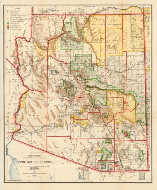
Colorful and fascinating map provides a detailed look at the territory just six years before Arizona obtained statehood in 1912. The extent of nine Indian reservations and four military reservations, (Fort Apache, Fort Grant, Fort Huachuca, and Fort Whipple) and numerous National Forest Reserves are clearly shown in different colors. Private land grants are outlined in gray. The Grand Canyon Forest Reserve is shown. Brown hachured mountainous areas and blue waterways further enhance the great visual impact. Details include watershed, mountains, railroads, wagon roads, private claims, unsurveyed townships, etc. Drawn by Daniel O'Hare, and lithographed by the Norris Peters Co., Photo-Litho.
References:
Condition: A
Short marginal tear at binding trim that just enters border, closed on verso.