Subject: Arizona
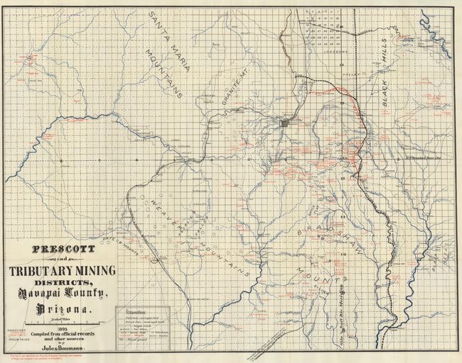
Period: 1895 (dated)
Publication:
Color: Printed Color
Size:
35 x 27 inches
88.9 x 68.6 cm
A large and fabulous mining map of the region around Prescott, Arizona in 1895. Locates hundreds of named mines, ranches, school houses, towns, railroads, roads, and post offices. The mines are named, located by a small "x" and printed in red. Includes the towns of Jerome, Prescott and Congress. The numerous rivers and streams are well shown with blue overprinting. The Prescott & Eastern Railroad, now completed to Mayer, is shown with red overprinting. Numerous rail lines are delineated and named including the narrow gauge line to Jerome that extends from the Verde Junction and crosses Mingus Mountain. Good detail of Jerome including its smelter. The Santa Fe, Prescott & Phoenix Railway is clearly shown. The Prescott and Arizona Central R.R. line extending north from Prescott appears to be cancelled through red overprinting. Another line extending from below the margin to Hot Springs is noted as a proposed railroad to connect with the Santa Fe, Prescott & Phoenix Ry. A great map of the region in fine condition.
References:
Condition: A+
Folding, as issued. One very small fold intersection split. A clean and bright example.