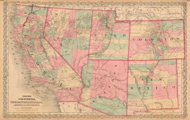
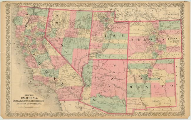
Subject: Southwestern United States
Period: 1872 (circa)
Publication: General Atlas
Color: Hand Color
Size:
26 x 16.8 inches
66 x 42.7 cm
This is the uncommon Colton issue, likely published about 1872 and certainly after 1869 as the Pacific Railroad is shown completed through Utah to the west coast. Arizona Territory has only its first four counties, namely Mohave, Yuma, Pima and Yavapai. Prescott is the territorial capital. New Mexico Territory retains some of its original 'strip' counties, and the Utah/Nevada border is now at 114°, its final location. The Pony Express route was shown on earlier editions, but is not present on this map. The map has exceptional information on railroads, both built and planned. It is filled with place names, information on topography and watershed, and numerous notes. For example, one note in west central Colorado states "Elevated plain, fertile, gently rolling with fresh water, lakes and timber." Fancy titling and decorative scroll-style border. Nice example of this handsome double page map.
References: Wheat (TMW) #1200.
Condition: A
Fine impression and coloring. Margins are close, as issued, with small amount of lower corner chipped off, well away from border. Toned at edges, with short split at lower margin. Map image is fine.