Subject: Western United States
Period: 1888 (dated)
Publication:
Color: Printed Color
Size:
29.2 x 17.4 inches
74.2 x 44.2 cm
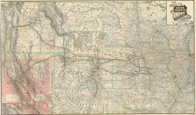
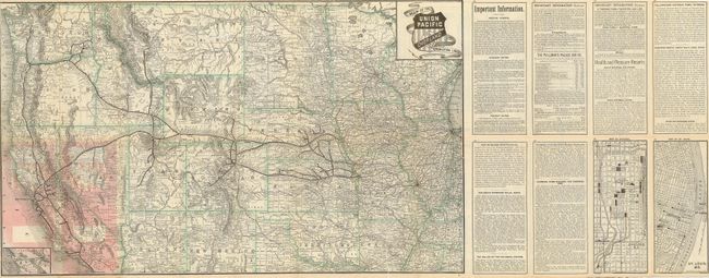
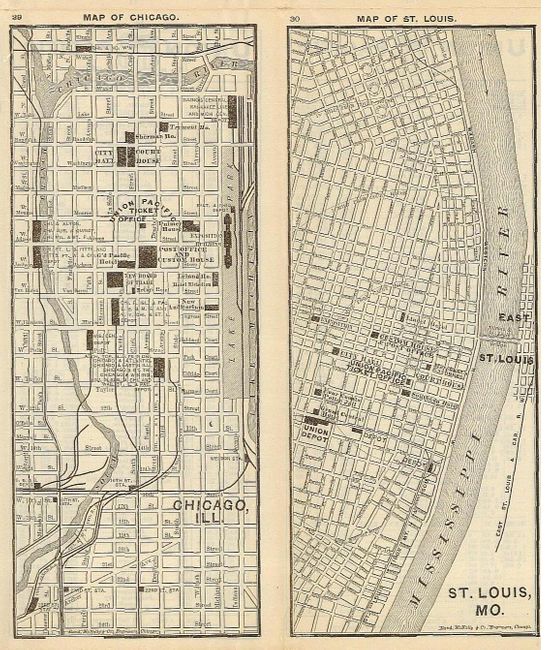
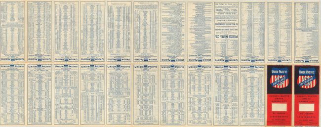
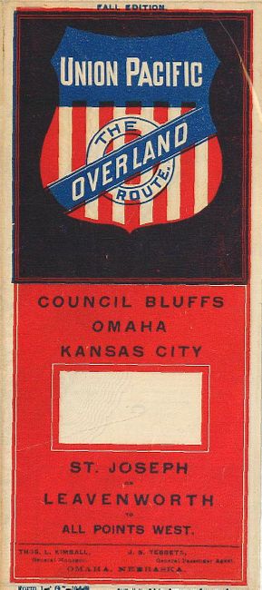
This is a folding map and timetable for the Union Pacific Railroad route. Originating in Kansas City, the rail routes flow west through Kansas, Colorado, Utah, Wyoming, and Idaho to the Pacific coast states. Each railroad is named with hundreds of rail stations located and likewise named. At lower left is a small inset showing the route of the Otay R.R. in Mexico with connections to San Diego and Ft. Yuma. On the map side is an eight panel section devoted to "Important Information" that covers information on baggage and freight rates, steamship connections to Alaska, Asia and Australia, "Health and Pleasure Resorts, and information and rates on the Pullman's Palace Car. There are town plans of Chicago and St. Louis with an emphasis on rail stations and ticket office locations. This great piece of railroad ephemera has an extensive timetable opposite the map. The timetable side is printed in blue; red and blue on the folded front covers feature the Union Pacific shield. The timetable was printed by Rand McNally & Co. and is dated October 1, 1888, and is noted as the "Fall Edition."
References:
Condition: A
This is a lovely example that is in near fine condition. A couple very small fold intersection splits.