Subject: United States - Central and Southwest
Period: 1856 (dated)
Publication: New Universal Atlas…
Color: Hand Color
Size:
13 x 16 inches
33 x 40.6 cm
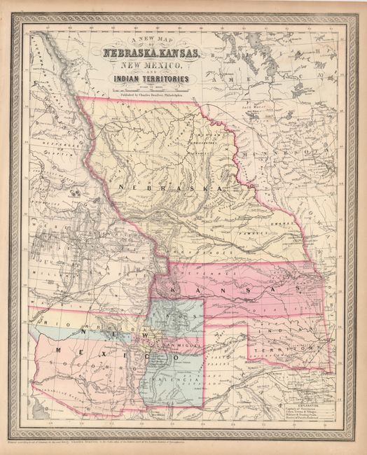
Fascinating map of the transitional states and territories from this important series originating with Samuel Augustus Mitchell. The map is filled with early county configurations, exploration routes, and various trails including the Santa Fe and Oregon Trail. Nebraska Territory extends between Canada and Kansas, with Washington and Oregon to the west and Minnesota in the east. Oklahoma is Indian Territory. New Mexico Territory extends from California to Texas and features the northern county of Taos that reaches into the future Colorado. Part of Utah Territory is shown and extends to Middle Park in present-day Colorado with its eastern border formed by Nebraska and Kansas.
References:
Condition: B+
A little faint toning in the upper right, else very good.