Catalog Archive
Auction 120, Lot 233

"Map of the Chicago, Rock Island & Pacific Railroad with its Branches", Rand McNally & Co.

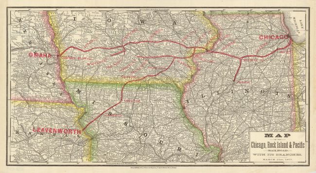
Subject: Central United States

Period: 1877 (dated)

Publication:

Color:

Size:
17.3 x 9.2 inches
43.9 x 23.4 cm
Download High Resolution Image
(or just click on image to launch the Zoom viewer)

This early Rand McNally map details the route of the Chicago, Rock Island & Pacific Railroad. The map covers the routes from Chicago to Leavenworth and Omaha with branches to Knoxville (IA), Winterset, and Peoria. Includes parts of Iowa, Nebraska, Kansas, Missouri, and Illinois. The underlying map is black & white with colored xylographic over-printing to show the rail lines, state boundaries, and city names. Dated March 31, 1877. The first known map by the firm was published in December 1872, and atlases were not seen until 1876.

References:

Condition: A+

A trace of paste residue at right margin from binding and one light water spot in lower margin, still fine.

Estimate: $80 - $120

Sold for: $140

Closed on 7/18/2007

Archived