Subject: Central United States
Period: 1837 (dated)
Publication: Military Affairs, Vol. VII, No. 753-A
Color: Hand Color
Size:
15.3 x 21 inches
38.9 x 53.3 cm
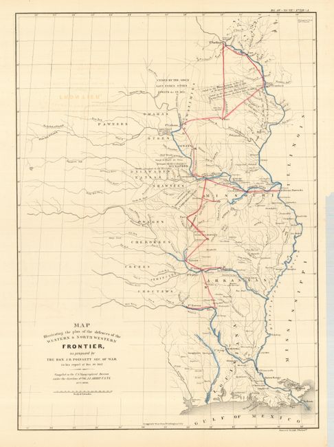
A historical map that was issued as part of the continuing debate over the nature of the Frontier Defenses between the Mississippi River and the Rocky mountains. Issued under the direction of Col. A.A. Abert by W. Hood, the map covers the states of Missouri, Arkansas and Louisiana and the Indian nations bordering them to the west. Locates many military forts and outposts from Ft. Jessup to Ft. Snelling with notations throughout concerning the regions ceded by several Indian nations with the dates of the treaties. Locates numerous Indian Tribes in relation to the nearby and encroaching cities and growing settlement areas. The threat posed by hostile Indians whose numbers greatly exceeded those of the settlers in the area, resulted in a protracted Congressional debate concerning the defenses required along the frontier. Published in Poinsett's report of 1837, which was issued in conjunction with a similar proposal by Charles Gratiot. This is the reissued map published in American State papers circa 1860.
References: Wheat (TMW) #426.
Condition: B+
The map has some light offsetting and a couple of marginal stains. Issued folded with a binding trim on the right, still with generous margins.