Subject: Upper Midwest
Period: 1705-28 (circa)
Publication:
Color: Black & White
Important trio of maps from Lahontan's fanciful depiction of the Riviere Longue.
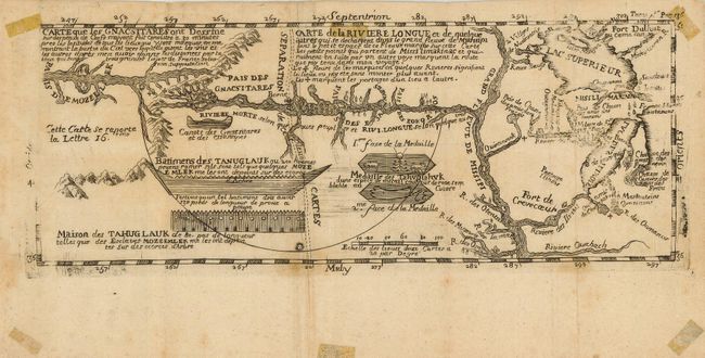
1) Carte que les Gnacsitares ont Dessine… Carte de la Riviere Longue et de quelque autres… is one of the most influential, and fanciful, maps in American cartographic history. It purports to show the Long River flowing from the mountains in the West, home to the Gnacsitares Indians, and connecting to the Mississippi River. On the western side of the mountains is another river, presumably flowing into the Pacific. Lahontan's concept was copied by virtually all 18th century cartographers including Moll, Senex, Popple, and Delisle, thus perpetuating the myth. The map also includes balloon-shaped Lakes Superior and Michigan. This is the third state of the smaller version. (11.6 x 4.6")
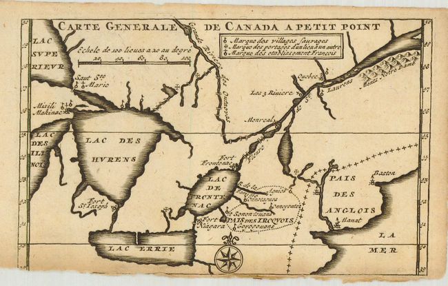
2) Carte Generale de Canada a Petit Point shows the waterways from the St. Lawrence to the Great Lakes, naming Fort Michilimacinac (Misili Makinac), as well as the forts of Niagara, St. Joseph and Frontenac. (5.6 x 3.4")
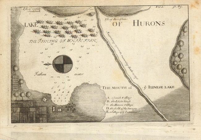
3) Lake of Hurons shows the Straits of Mackinac, which connects lakes Michigan and Huron. This small map shows soundings in fathoms, a fleet of fishing boats, and a lettered key locates the important buildings on the coast. Oriented with north to the left by a large compass rose. (6.3 x 4.1")
References: 1) Kershaw #301. 2) Kershaw #282.
Condition: B
Map 1 has a slightly uneven impression and tape residue, primarily in the margins but just touching the map at the top corners. Map 2 has a nice impression. The lower margin is missing with a little bit of neatline loss. Map 3 has some scattered foxing.