Subject: Southeastern United States
Period: 1812 (circa)
Publication:
Color: Black & White
Size:
19.5 x 13.4 inches
49.5 x 34 cm
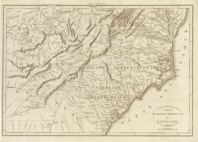
French edition of this interesting map that covers all of the Carolinas with parts of Virginia, Kentucky, Tennessee and Georgia. Between Tennessee and Georgia is a long strip of land labeled United States Territory. This land originally belonged to South Carolina but was ceded back to the United States in 1787. Numerous Indian villages are shown, especially in the region of present-day Alabama. The map was likely published in "Histoire de la Guerre de l'Independence des Etats-Unis" by Carlo Botta. The plate is nearly identical to the 1807 edition, lacking III at top right.
References:
Condition: B+
Crisp and dark impression on bright paper. Some faint offsetting and foxing. Hinge remnant on verso.