Subject: Southcentral United States
Period: 1866 (dated)
Publication:
Color: Hand Color
Size:
38 x 25 inches
96.5 x 63.5 cm
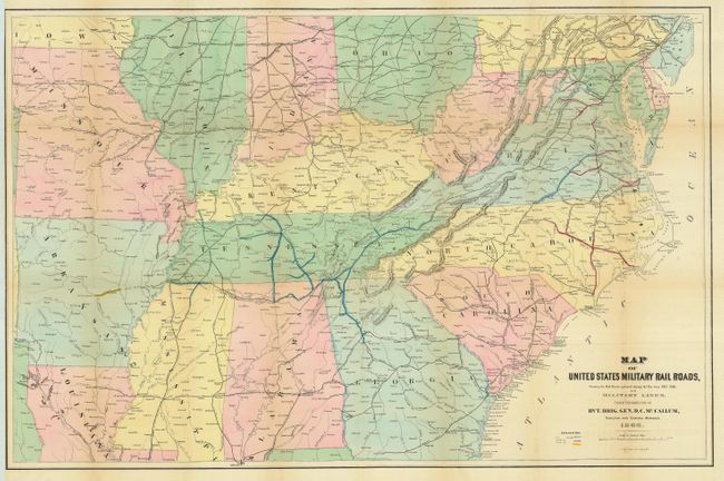
Interesting map produced the year following the close of the Civil War. It provides a clear picture of the railroads involved in the theater of operations during the Civil War. The map is filled with named railroads and stations. The legend uses hand coloring to delineate the various rail gages throughout the map including 5 ft., 4 ft. 8 1/2 in., and 5 ft. 6 in. gauges. The map is centered on Tennessee and extends northward to show much of Pennsylvania, Ohio, Indiana, and Illinois. To the west is Missouri, with parts of Arkansas and Louisiana, but not to the Gulf Coast. It is filled with place names including some errors like Marks Corner for Moncks Corner, South Carolina. Good detail along the Atlantic coast. Large enough to easily track military operations and troop movements. This map is seldom offered and less frequently in this condition.
References:
Condition: B+
A bright example with fine original coloring and full margins. Folding, as issued. A couple of fold intersection splits, closed on verso and a small crescent puncture that is not visible from front, also closed on verso.