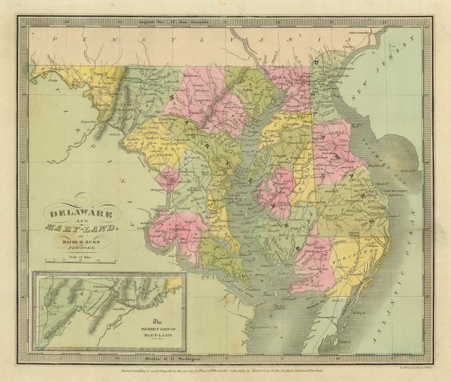
Subject: Delaware and Maryland
Period: 1833 (dated)
Publication: A New Universal Atlas
Color: Hand Color
Size:
12.5 x 10.5 inches
31.8 x 26.7 cm
Detailed and nicely hand colored map also includes the northern part of Chesapeake Bay, Delaware Bay and the Atlantic. This handsome map has full original wash color and keyboard-style border. The map delineates roads, towns, villages and settlements, ports, watershed and more. At lower left is an inset of "The Western Part of Mary-Land." The map is without a page number, which Rumsey notes as indicating the map is from an atlas that pre-dates the one held by the LOC. Burr was appointed to be topographer to the U.S. Post Office Department in 1832 and was unable to complete the maps for the atlas. Thomas Illman assumed responsibility to complete the atlas, publishing it in 1835 using the New York firm of D.S. Stone. The imprint of Illman & Pilbrow is below the neatline.
References:
Condition: B+
Very nice original coloring. A few light foxing spots in blank area of green wash hand coloring.