Catalog Archive
Auction 120, Lot 201

"A Map and Chart of Those Parts of the Bay of Chesapeak York and James Rivers which are at Present the Seat of War", Lodge, John

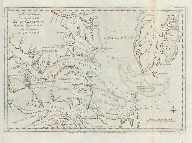
Subject: Mid-Atlantic

Period: 1781 (dated)

Publication: Political Magazine

Color: Black & White

Size:
14.5 x 10 inches
36.8 x 25.4 cm
Download High Resolution Image
(or just click on image to launch the Zoom viewer)

Rarely seen Revolutionary War map shows the seat of the Battle of Yorktown, where the British General Cornwallis surrendered on October 19, 1781, effectively leading to the end of the war with Britain. This map was published in the November 30th, 1781 edition of the magazine, not long after the battle. The map shows soundings in fathoms, the locations of Rochambeau and Washington's armies, as well as those of the ill-fated Cornwallis. A French fleet is located off of Cape Henry.

References: Jolly POL-38; Nebenzahl (Biblio) #180.

Condition: B

The map has been backed with Japanese tissue, repairing some tears in the map that have led to a small amount of inconspicuous loss in the printed area.

Estimate: $450 - $550

Sold for: $550

Closed on 7/18/2007

Archived