Subject: Colonial Mid-Atlantic
Period: 1780 (circa)
Publication: Atlas moderne portatif…
Color: Hand Color
Size:
8.7 x 7 inches
22.1 x 17.8 cm
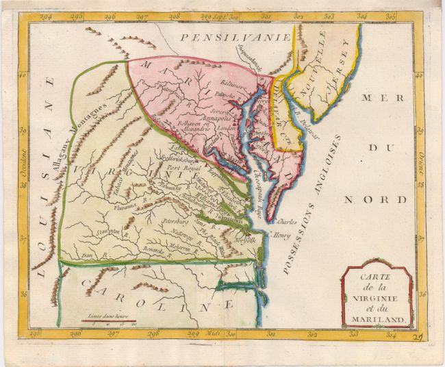
This is an uncommon, interesting map of Mid-Atlantic region. Maryland is an ill-defined wedge between Virginia and Pennsylvania and does not extend beyond the Appalachians. Maryland's most prominent settlement is St. Marie, the colony's first capital. The Delaware boundary indicated on the map was made following the conclusion of a long land dispute between Lord Baltimore and the Penn family in 1760. Strangely, Philadelphia is missing from the map while Alexandria is also called Belhaven. The colonies are labeled Possessions Angloises and Louisiane is clearly marked on the western slope of the Allagany Montagnes. Locates many interesting areas including the Tabaco Mtns.
References:
Condition: B+
Nice impression attractive later color. The top margin has been extended to accommodate framing.