Subject: Colonial Northeast
Period: 1764 (published)
Publication: La Petite Atlas Maritime
Color: Black & White
Size:
14.8 x 12.8 inches
37.6 x 32.5 cm
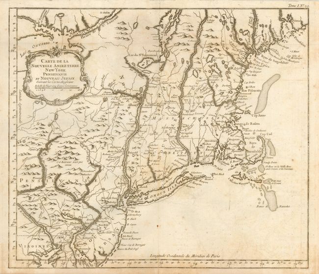
This is the uncommon, larger version of Bellin's map of New England that is based on the cartography of Moll. It is not to be confused with Bellin's smaller, more common map of nearly the same title. The map shows the area from Penobscot Bay in Maine down to Little Egg Harbor in New Jersey and a bit of Delaware Bay, and west to Lake Ontario. Cape Cod is shown as an island, and Martha's Vineyard is named Martha's Wineyard. It is finely engraved and filled with place names both along the coast and inland, including Casco Bay, Cape Porpoise, Cape Anne, Boston, Providence and many more. Delicately adorned with a lovely rococo-style title cartouche.
References: McCorkle #764.1; Sellers & Van Ee #723 & 764.
Condition: B
On thick hand laid paper will full margins. A little scattered foxing, mostly in lower right quadrant.