Subject: United States
Period: 1829 (dated)
Publication:
Color: Hand Color
Size:
7.5 x 9.5 inches
19.1 x 24.1 cm
A terrific set of finely engraved and highly detailed maps in full, vibrant color.
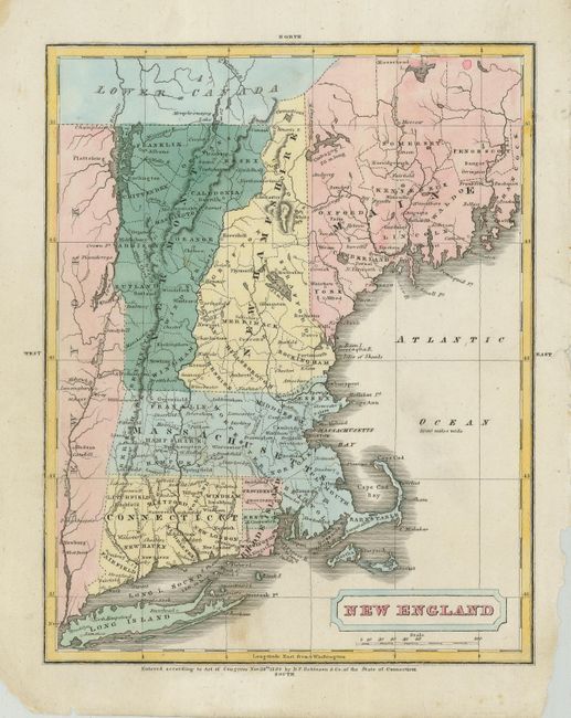
1) New England is filled with place names, county divisions, forts and topography.
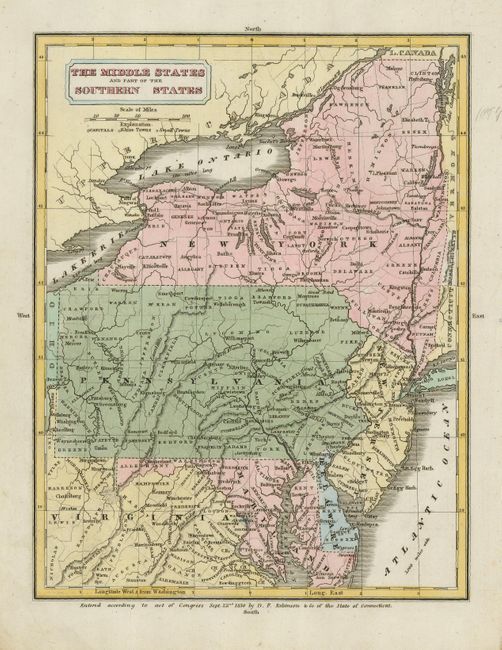
2) The Middle States and Part of the Southern States covers this part of the country from New York south to the center of Virginia and west to Ohio. Nicely engraved and very detailed.
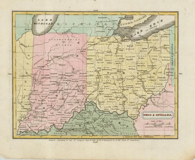
3) Ohio & Indiana shows numerous place names, county divisions and topography in excellent detail.
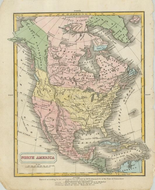
4) North America shows the northern boundary of Oregon well into British Columbia as determined in 1824. Alaska and northwestern Canada are still Russian possessions. Many place names and topographical features are noted.
References:
Condition: B+
Maps are generally very good with some light soiling. Edges and corners are worn and have some loss, well away from maps.