Subject: Reference Books
Period: 1988-90
Publication:
Color:
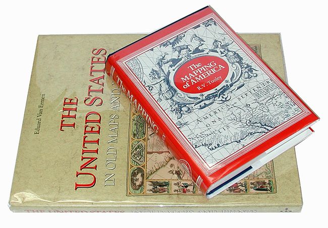
1) The United States in Old Maps and Prints, by Eduard van Ermen, Wilmington, DE, 1990. This beautifully illustrated book features 78 rich, colorful reproductions of maps of the United States covering three centuries, from 1570 to 1870. A terrific reference for an important subject that is described by the author as follows, "Whereas in Europe the primary task of cartography was to visualize a densely populated and long-known continent, in America the challenge was much greater: the growth of cartography went hand in hand with the exploration and colonization the previously unknown continent." Folio (12 x 15.3"), hardbound in beige cloth with gilt titling on front and spine, with dust jacket and plastic cover.
2) The Mapping of America, by R.V. Tooley, London, 1988. This is an excellent reference work detailing the cartographic history of North America. It contains a compilation of essays by Tooley and some of the most respected scholars of the 20th century. The chapters include French mapping of the Americas, Comparative Cartography (Steven & Tree), California as an island, Smith's Virginia and its Derivatives (Verner), The Marine Surveys of James Cook (Skelton & Tooley), North American City Plans, Maps of the Yorktown Campaign (Verner), Jansson-Visscher Maps of New England (Campbell), A Sequence of Maps of America, Mapping the Great Lakes, and Identification of the Maps of America in Ortelius' Theatrum. Second edition; third impression, 519 pp., with 179 b/w plates. 8vo, hardbound in blue cloth with gilt title on spine, with dust jacket in protective sleeve (7.3 x 10.3").
References:
Condition: A+
As new condition.