Subject: Reference Books
Period: 1969-96
Publication:
Color:
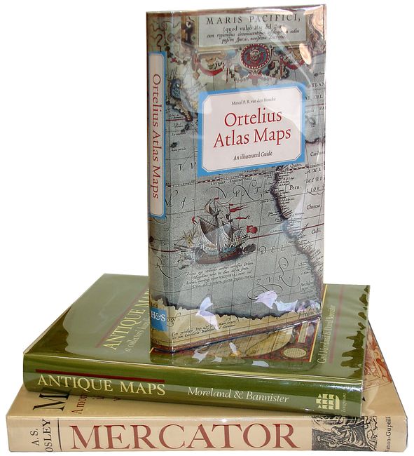
1) Ortelius Atlas Maps An Illustrated Guide, by Marcel P.R. van den Broecke, 1996. This book provides information on the maps which were included in the first regular atlas that ever appeared, Ortelius' "Theatrum Orbis Terrarum." It is the standard reference for Ortelius' maps. 8vo (5.5 x 9.8"), hardbound in blue cloth with gilt titles on front and spine, with illustrated dust jacket with plastic protection.
2) Mercator… by A.S. Osley, foreword by R.A. Skelton, New York, 1969. Subtitled, "A monograph on the lettering of maps, etc in the 16th century Netherlands with a facsimile and translation of his treatise on the italic hand and a translation of Ghim's Vita Mercatoris." 4to (9 x 11.5"), hardbound in blue cloth with decorative gilt titles on front and spine, with dust jacket with plastic protection.
3) Antique Maps A Collector's Handbook by Carl Moreland and David Bannister, London, 1983. This exhaustive reference is illustrated with numerous images of maps in black and white, and several in full color. Signed by both authors on title page. 8vo (7.8 x 10"), hardbound in green cloth with gilt title on spine, with decorative dust jacket with plastic protection.
References:
Condition: A+