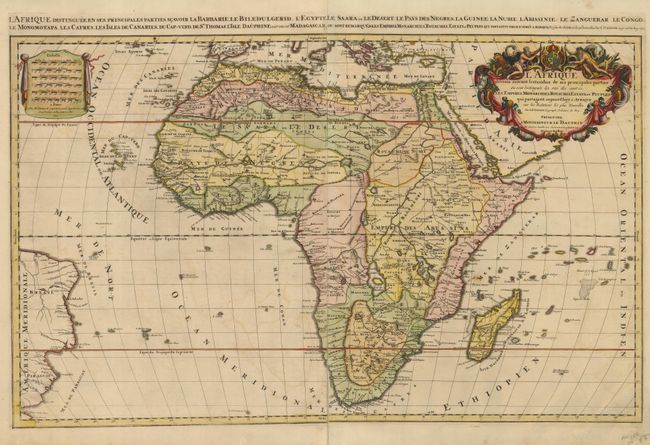
Subject: Africa
Period: 1692 (dated)
Publication: Atlas Nouveau
Color: Hand Color
Size:
34.8 x 21 inches
88.4 x 53.3 cm
This large and striking map is Jaillot's first map of the continent and is an enlarged version of Sanson's earlier map. The source of the Nile is shown on the Ptolemaic depiction originating from two lakes below the Equator. A large section of South America is shown and two St. Helena islands appear - a common error in maps from this period. The large distance scale cartouche has six scales. The very large and decorative title cartouche is filled with symbols of Africa, including native figures, cornucopias, elephant, crocodile, lion and ostrich under the coat of arms of the Dauphin. Two sheets joined, as issued.
References: Norwich #46, Tooley (AF) p.56, plt. #41.
Condition: B
Attractive color and a nice, sharp impression. There is some light offsetting and a few spots of foxing in the map. The margins have some short tears and some separations on the centerfold. The centerfold separations have been repaired on the verso.