Subject: Asia - Central
Period: 1866 (dated)
Publication:
Color: Hand Color
Size:
38 x 27 inches
96.5 x 68.6 cm
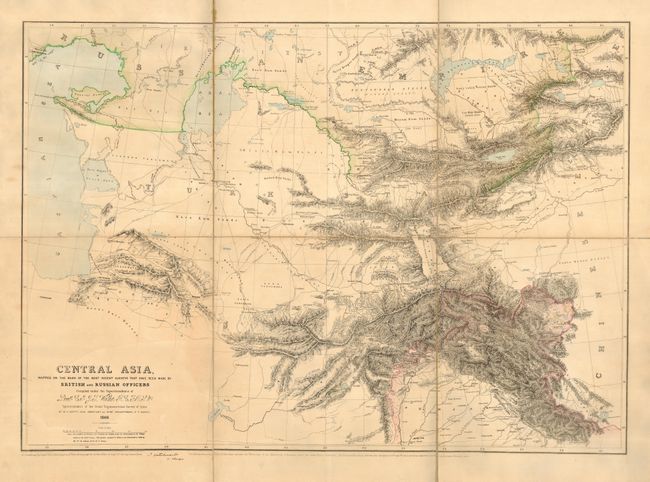
Fascinating document created by Lt. Col. J. G. Walker for the important Great Trigonometrical Survey of India. This process of surveying was begun in 1802, and provided a very good series of precise mapping points to assist with later topographic and cadastral mapping. This map shows the area from the Caspian Sea and Iran to China, with Pakistan and Afghanistan in the southern portion of the map. This map was published in Dehradun, India. At the bottom is the notation; "The British Boundary Line in this map includes the territories of the Maharajah of Kashmir, which are under British protection." The British Boundary Line mentioned is pink and includes a portion of Pakistan as well as Kashmir. Dissected and folding into brown linen self-backs (14 x 16").
References:
Condition: B
Couple small fold separations and part of the line backing has been removed.