Subject: Middle East
Period: 1719-1868 (circa)
Publication:
Color: Hand Color
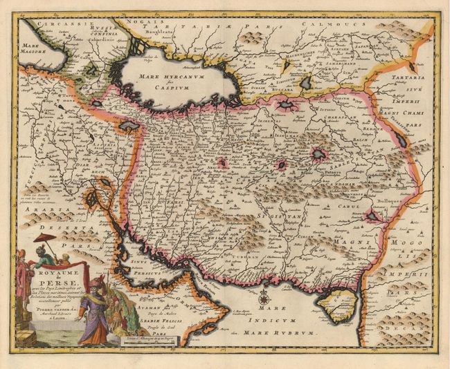
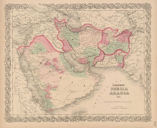
Interesting pair of maps of the Middle East spanning the 18th and 19th century and providing a great contrast in style and information.
1) Royaume de Perse, avec les Pays Limitrophes...… is a lovely, decorative map of the Persian Empire by Pierre Vander Aa. The cities and mountains are graphically depicted and this map features a beautiful figurative cartouche. The map shows the area that is now Iran, Afghanistan and Iraq with a portion of Oman near the Persian Gulf. This was published in Leiden in 1719. (13.7 x 11")
2) Colton's Persia Arabia &c by G.W. and C.B. Colton & Co. is an attractive, 19th century map of the Arabian Peninsula and encompassing present-day Iraq, Iran, Afghanistan and Pakistan. The map is filled with detail of the topography and towns of the region. Related text on the verso. (15.7 x 12.7")
References:
Condition: A
Both very good with a small hole in the margin of map 2, not affecting map.