Subject: Mediterranean
Period: 1682 (published)
Publication: d'Onder-Aardse Weereld
Color: Hand Color
Size:
22 x 13.2 inches
55.9 x 33.5 cm
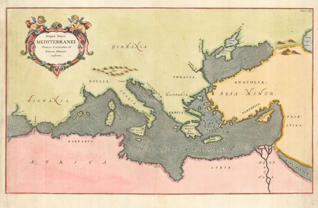
An unusual map from Kircher's masterpiece, the first serious effort to describe the physical makeup of the earth, proposing theories (sometimes fantastic) in the areas of physics, geography, geology, and chemistry. The map is devoid of political information and instead focuses entirely on ocean currents in the Mediterranean Sea. The map extends to include the Black Sea and parts of the Caspian and Red Sea. Kircher's theories included the notion that the world's oceans were all interconnected and subterranean tunnels are shown connecting the oceans and seas. The decorative title cartouche is surmounted by two putti. Published in a Dutch edition of Kircher's famous Subterranean World by Johann Waesberger.
References:
Condition: B
Near invisible, professional repair at the left margin, with the lower portion of the neatline in facsimile.