Subject: Scotland
Period: 1690 (circa)
Publication:
Color: Hand Color
Size:
19.5 x 22.5 inches
49.5 x 57.2 cm
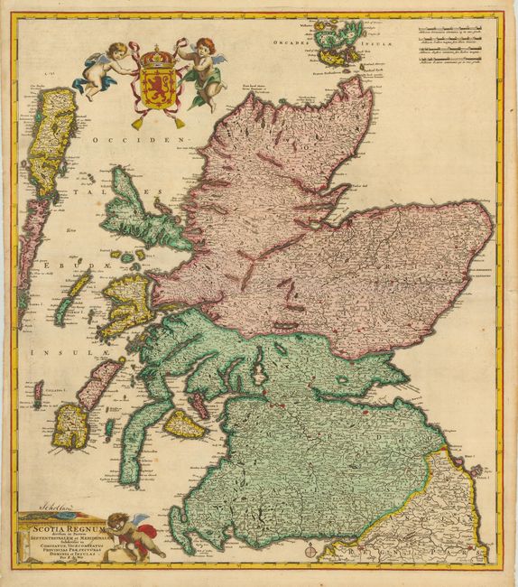
This is a superb, classical Dutch map of Scotland showing immense detail of the cities and towns. The Outer and Inner Hebrides are depicted with good detail, and the Orkney islands are shown as well. Hadrian's Wall, noted on the map as Pictes Wall is shown running across from Solway Firth to Newcastle in England near the border with Scotland. The map is adorned with a coat-of-arms being carried aloft by two cherubs, and the title is enclosed by a classical pediment being attended by yet another cherub.
References:
Condition: B
Sharp impression with very nice old color. The map has narrow, but adequate, original margins on the left, with some short tears that just enter the map and have old paper repairs on the verso. There are a few spots of foxing, as well as "Schotland" written above the cartouche in brown ink, in a contemporary hand.