Subject: North Pole
Period: 1625 (published)
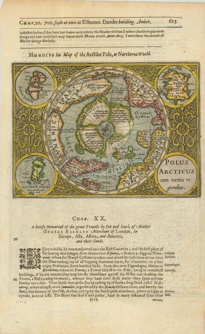
Publication: Purchas His Pilgrimes
Color: Hand Color
Size:
7.3 x 5.2 inches
18.5 x 13.2 cm
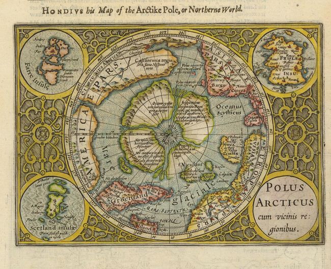
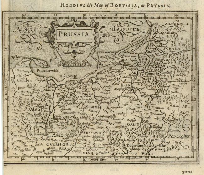
This is a reduced version of the second state of Mercator's famous North Pole map. It depicts the region between the pole and the Arctic Circle. This is one of the most intriguing early maps, combining medieval geographic concepts with some of the most advanced cartography of its day. The North Pole is shown as a rocky island surrounded by 'indrawing seas' between four huge islands. The map shows an awareness of recent discoveries, including those of Frobisher and Davis, as well as the northern sea passage through America to Asia. It is a striking example of baroque engraving, with the map set off by the roundel title cartouche and inset maps of the Faeroes, the Shetlands and the mythical Frislant Insula in the corners, and framed by a border of interlocking acanthus designs. The map is printed on a full sheet of English text with "Hondius his Map of the Arctike Pole, or Northerne World" outside top border. There is an uncolored map of Prussia on verso.
References: Burden #154; Kershaw #28.
Condition: A+