Subject: Britain
Period: 1749 (dated)
Publication:
Color: Hand Color
Size:
21.3 x 18.5 inches
54.1 x 47 cm
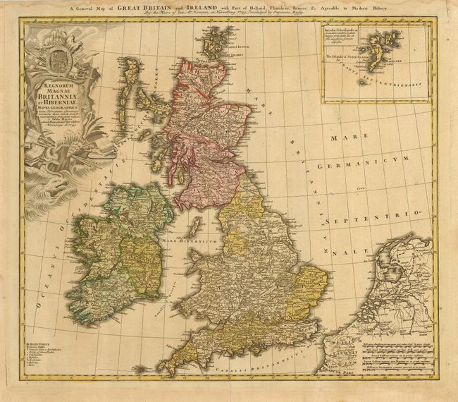
A handsome map of the British Isles with very good detail of Ireland, England, Scotland and Wales. The map has an inset of the Shetland Islands and includes the adjacent parts of Holland and Belgium. A key at lower left includes symbols for cities, towns, villages, universities, forts and redoubts. The map is decorated with a ornate cartouche with a sea monster, shells, a coat of arms and the accoutrements of battle. Titled in English along the top of the map.
References:
Condition: B
Original color that has faded a little. Marginal damp stains that do not come into the map, but do affect a bit of the title at top with some archival tape on the verso to reinforce paper edge.