Subject: Atlantic Ocean
Period: 1825 (dated)
Publication:
Color: Black & White
Size:
35.3 x 22.3 inches
89.7 x 56.6 cm
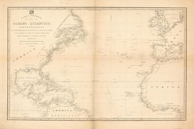
This very uncommon sea chart was created for Guadalupe Victoria, the first president of Mexico shortly after Mexico gained independence from Spain. The map is a copy or a derivative of a map created in Spain by the Direccion de Hidrografia (Spanish Hydrographic Service) by M. Moreno. This map is one of five or six that were issued in 1825 by the new Mexican government. The map details the Atlantic coastlines from Labrador to Brazil in the Americas and from Scotland to the Gulf of Guinea. The prime meridian is noted as being in Cadiz on this chart.
References: cf Lowery #746.
Condition: C
Some very old tears have been closed on the verso with old paper repairs and some archival tape. There are a few small stains and some toning on the folds.