Subject: Atlantic Ocean
Period: 1820 (circa)
Publication: Geographical Atlas
Color: Hand Color
Size:
16.5 x 19 inches
41.9 x 48.3 cm
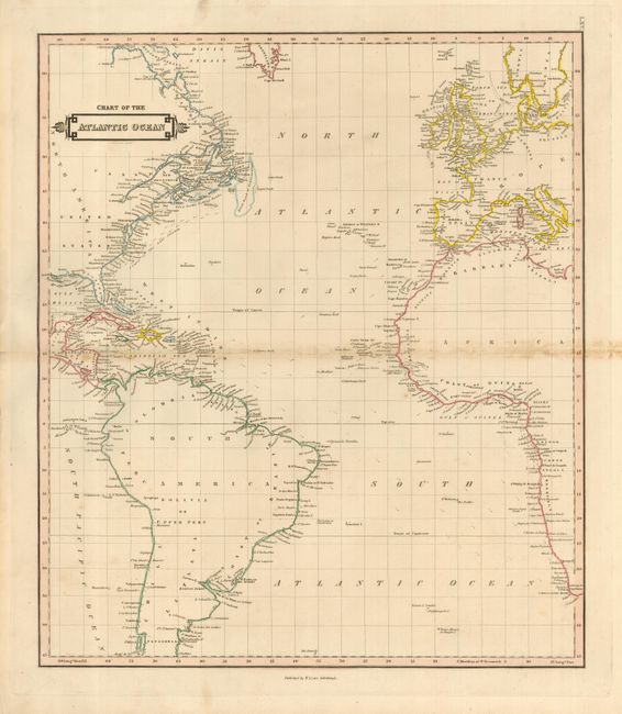
This uncommon issue predates the Atlantic Telegraphic Cable with no suggestion of its pending construction. With detail limited to place names along the coastlines, the map extends to show the U.S. to New Orleans and in South America to Patagonia. In the Eastern Hemisphere the map stretches to include Scandinavia and Prussia, and south to include the Cape of Good Hope. There is good detail of the various islands in the Atlantic, the direction of prevailing currents including the Gulf Stream, and more.
References:
Condition: B
The map has full margins and original coloring in outline. Short marginal split at left centerfold, and some foxing or staining along centerfold.