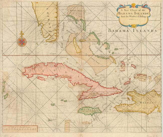
Subject: Bahamas and Greater Antilles
Period: 1749 (circa)
Publication: English Pilot
Color: Hand Color
Size:
20.5 x 17 inches
52.1 x 43.2 cm
Extremely rare sea chart of the Bahamas, including the tip of Florida, Cuba, Jamaica, the western part of Hispaniola, and Cozumel to the far west. This chart is from a pirated Irish edition of the English Pilot by George Grierson. The map is a close copy of the Mount & Page 1737 edition, and differs from it with rhumb lines crossing the land, as well as a general lower quality of engraving and paper. The map is decorated with a great compass rose and a handsome cartouche.
References:
Condition: B
Very nice, delicate color with some light soil and toning on centerfold. The sides have been trimmed close on the sides, with loss of the neatline on the right. Small tear in lower blank margin has been repaired with archival tape. Still a good example of a scarce map.