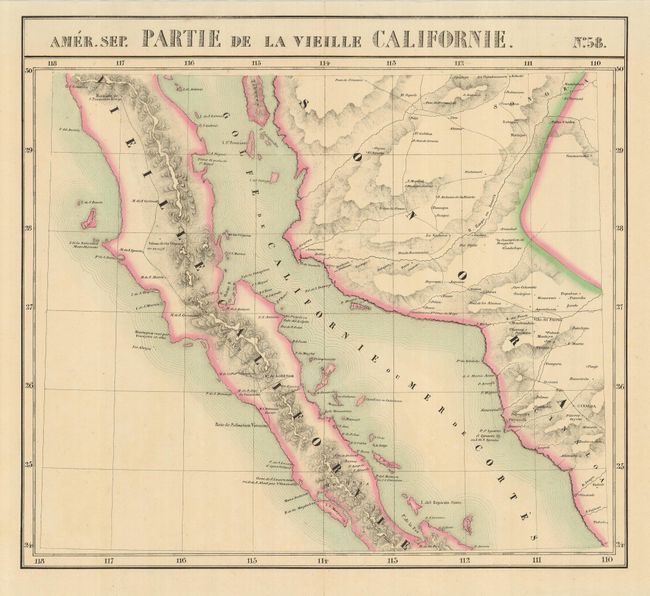
Subject: Mexico, Baja
Period: 1827 (published)
Publication: Atlas Universel
Color: Hand Color
Size:
20 x 18 inches
50.8 x 45.7 cm
This fine lithographed map covers the Baja from Isle Redonda and the Mission de San Francisco Borja to La Paz. This was the first atlas map to provide such a fine level of detail in the Baja. The Atlas Universel was a monumental work and milestone in cartography; particularly the cartography of the American West. It was the first atlas of the world with all maps on the same scale (1: 1,641,836 - about one inch to 26 miles) and the first lithographed world atlas. The maps (400 in all) were intended to be joined together, thus forming a globe measuring 7.75 meters in diameter. There was only one edition, published in a series of parts between 1825-27, and the subscription list shows that a mere 810 copies were sold.
References:
Condition: A
Short fold separations are closed on verso with archival tape.