Subject: Mexico
Period: 1723 (circa)
Publication:
Color: Black & White
Size:
11 x 7.8 inches
27.9 x 19.8 cm
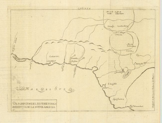
This simple outline map of Nueva Galicia is based on Juan López de Velasco’s manuscript and covers the western part of present-day Mexico. Some of the early Spanish settlements are named including Guadalajara, San Miguel, Xeres, Compostela, Durango, and S. Martin. Locates a large Lake Chapala and pto. de la Navidad, near today's Barre de Navidad and just south of Puerto Vallarta. The map extends north along the coast to name the R. de Na. Senora and shows the island Guayaual, most likely a reference to the land bar creating the Laguna del Caimanero south of Mazatlan.
Antonio de Herrera Y Tordesillas was the official historian of Spain and the Indies. He compiled a history of the Spanish conquests and early explorations in the Americas, complete with several engraved maps of the region. His work (Historia general de los hechos de los Castellanos) was originally published in 1601 with several editions and translations thereafter. This map appears to be from the 1723 edition by Torquemada or the 1726 derivative by Rodriquez.
References:
Condition: A
Printed on fine hand laid paper with large watermark and original margins. A little printer's ink residue at lower left in blank area of map, small stain in blank margin.