Subject: United States & Mexico
Period: 1862-1863 (dated)
Publication: Senate doc 1, Special Session 1863
Color: Black & White
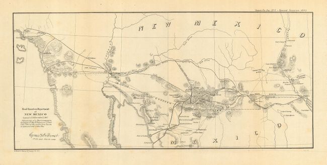
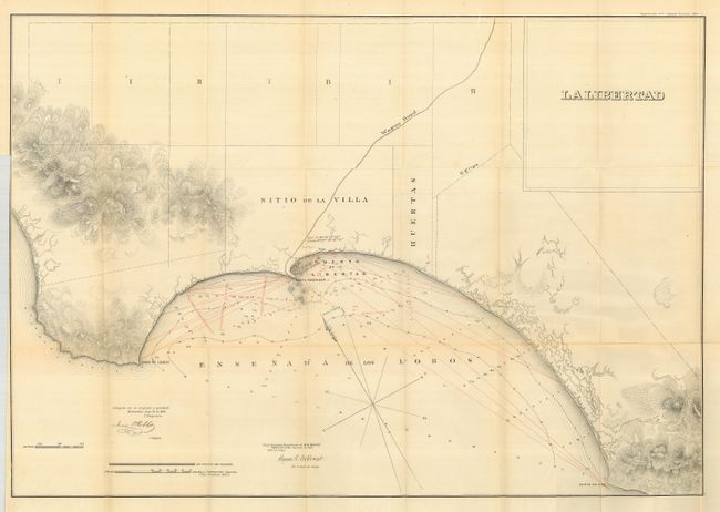
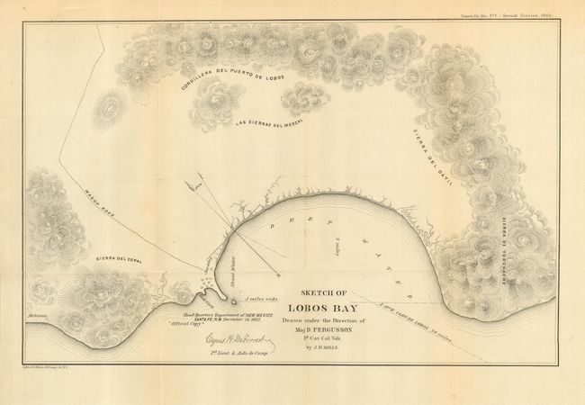
Set of Civil War period maps illustrate the supply routes in New Mexico Territory and vicinity to the Pacific. Each was published under the direction of the Head Quarters in Santa Fe and are signed in the plate "Cyrus H. DeForrest, 1st Lieut. & Aide-de-Camp." Major David Fergusson explored the territory between Tucson and Lobos Bay, Mexico to see if this would be a better supply route for Arizona than the currently used Texas and Kansas City route. Following the expedition, he strongly advocated this route as well as the purchase of parts of northern Sonora as necessary to give the U.S. a port in Arizona.
The first map delineates the border territory extending from Los Angeles and Baja California to El Paso. Routes from Tucson into Mexico and several "practicable railroad routes" are identified. 1863. (14.3 x 6.5")
The second map details the area around Mexico's Puerto de la Libertad, here called Ensenada de los Lobos, in the state of Sonora. Recently surveyed soundings in the harbor are shown in red overprinting. 1863. (28.5 x 20.3")
The last map details Lobos Bay, naming Seal Cove and the village of Jacates. 1862. (14.5 x 9.5")
References: 1) Wheat (TMW) #1028.
Condition: B
All are folding and on sound paper. Some very light folding toning and a little light foxing near title in first, else very good.