Subject: Wyoming
Period: 1881-82 (circa)
Publication: HR Doc. Part 2, 37th Congres, 1st Session
Color:
Size:
33 x 22.5 inches
83.8 x 57.2 cm
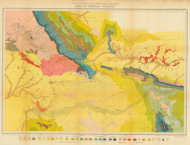
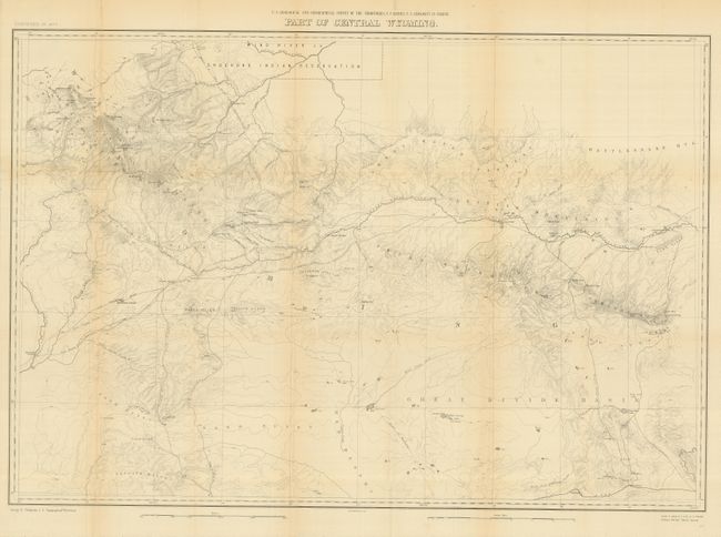
A nice pair of complementary maps covering the same region. The first is one of six distinctive maps of Wyoming from this important early survey. The map extends from part of the Wind River Reservation south to Rawlins. It displays the full course of the Sweetwater River, South Pass, etc. and depicts trails throughout the region. Remarkable detail is shown with contour intervals at 200 feet and a scale of 4 miles = 1 inch. Old wagon roads, trails and the Union Pacific Railroad are featured. Color and pattern icons at the bottom provides the key to the 32 different geological types. Wheat draws attention to the map's value to students of the Fur Trade and overland immigration routes. The second map is identical, but contains only geographical information without the geological information. The maps were published in Hayden's 12th Annual Report, published in 1883 from surveys accomplished in 1877. With this publication, the maps finally adopted the contour system (instead of hachure).
References: Wheat (TMW) #1296.
Condition: A
A very fine example with bright coloring and clean paper, with just a few short marginal splits. The uncolored edition is also very good.