Catalog Archive
Auction 119, Lot 360

"Johnson's Map of the Vicinity of Richmond, and Peninsula Campaign in Virginia Showing also the interesting localities along the James, Chickahominy and York Rivers", Johnson and Ward
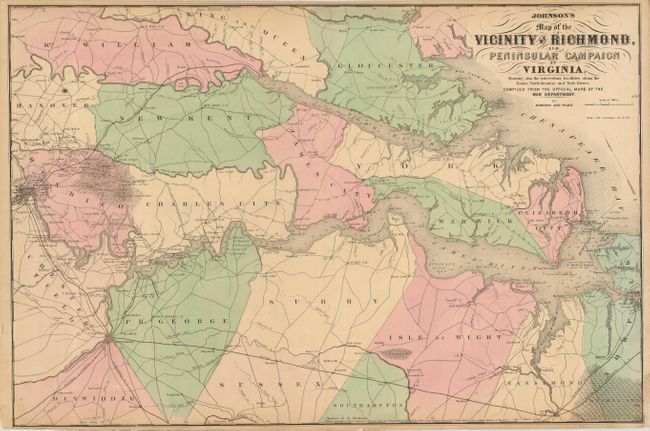
Subject: Virginia

Period: 1862 (dated)

Publication: New Illustrated Family Atlas of the World

Color: Hand Color

Size:
26.5 x 17.5 inches
67.3 x 44.5 cm
Download High Resolution Image
(or just click on image to launch the Zoom viewer)

A very interesting Civil War map that was compiled from the Official Maps of the War Department. This fully colored and well-engraved map covers the region of the James, Chickahominy and York Rivers, and includes the cities of Norfolk, Richmond, and Petersburg. The map shows great detail of military movements, lines and fortifications. It notes the location of the "contest" between the Monitor and Merrimac on 9 March 1862, the Confederate evacuation of Yorktown, May 4 1862, the battle in the vicinity of Williamsburg, May 5 1862, the battle of Malvern Hill and several other military engagements in the vicinity of Richmond.

References:

Condition: B

Narrow, but adequate, margins with some paper laid-in at lower right to replace loss.

Estimate: $120 - $160

Sold for: $70

Closed on 5/9/2007

Archived