Subject: Oklahoma
Period: 1895 (dated)
Publication:
Color: Printed Color
Size:
17 x 21 inches
43.2 x 53.3 cm
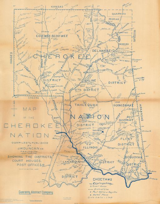
This interesting map was prepared by James William Duncan, a member of the Cherokee tribe. The map is full of detail and names districts for the Quapaws, Peorias, Ottawas, Wyandottes and Seneca tribes as well as the Cherokee. It portrays the administrative divisions and boundaries, court houses, tribal capitals, towns, railroads, ferries, salt works, prairies, schools, drainage patterns and some relief shown by hachure. It was originally compiled and printed in 1895, but this slightly smaller version was printed about 1928 by the Guarantee Title Company of Tulsa.
References: Donald A. Wise, Tulsa Annals, vol. XXXI, no. 3 of 3, Summer, 1996, pp. 20-22.
Condition: B
Blue printing on cream paper that has toned a bit unevenly. The central fold has a small hole.