Subject: Oklahoma
Period: 1888-98 (circa)
Publication:
Color: Printed Color
Very interesting pair of 19th century maps illustrating development in Oklahoma.
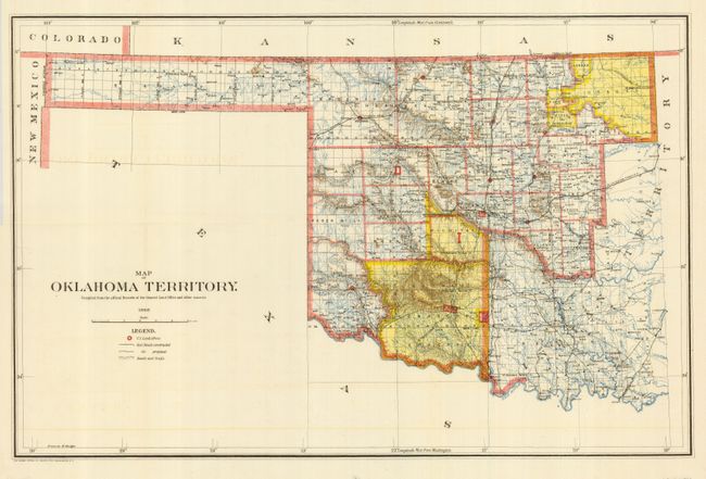
1) Map of Oklahoma Territory was made by the General Land Office in 1898. It is focused on the western part of Oklahoma, which at that time was separated from Indian Territory. The map is filled with detail of the early counties, towns, military reservations and topography. It also locates U.S. Land offices, railroads constructed and those proposed, plus roads and trails throughout the territory. (22 x 14.25")
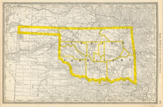
2) Rand McNally & Co.'s Indian Territory shows the territory as it was in 1888, with the whole territory given as land for the Native American tribes who had been displaced. The nations shown include the Kiowa, Chickasaw, Cheyenne, Arapahoe, Cherokee and Choctaw. (19.75 x 12.75").
References:
Condition: A
Both very good with a little light offsetting on map 1.