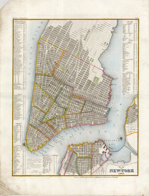
Subject: New York City
Period: 1844 (dated)
Publication: Hand Atlas
Color: Hand Color
Size:
11.6 x 14.3 inches
29.5 x 36.3 cm
This finely engraved map of New York City is based on Tanner's map of the city from the late 1830's. The map extends to include parts of Brooklyn and Williamsburg. Extensive tables at sides list public buildings, squares, markets, hotels, and churches. There is excellent detail throughout with all streets named and many port features identified.
References:
Condition: A
A cleaned and pressed example with fine later coloring in outline. The map has a crisp impression and full margins. The tip of the upper left corner is missing and the lower left corner exhibits some creasing, both well away from the image.