Subject: New York and Vermont
Period: 1778 (dated)
Publication: London Magazine
Color: Hand Color
Size:
7.5 x 10 inches
19.1 x 25.4 cm
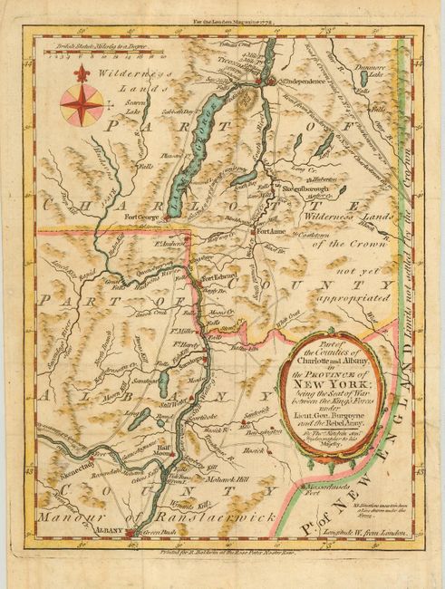
This scarce little map covers the region from Albany to Ticonderoga and locates principal forts, settlements, roads and waterways. The map illustrates the area involved in the first major defeat of the British in the Revolutionary War. On August 16, 1777 at Battle of Bennington, the American forces routed the British, leading to the surrender of John Burgoyne's 6000-man force at Saratoga on October 17. The battle is seen as the turning point in the war and convinced the French that the Americans were worthy of military aid. The region west of Lake George is labeled Wilderness Lands and the region of present-day Vermont is marked Wilderness Lands of the Crown not yet appropriated. In fact this region was not a part of New York, but part of the Vermont Republic that had been created in January 1777 after a dispute between New Hampshire and New York concerning ownership of the region.
References: Jolly, LOND-320.
Condition: B
Map was issued folding and is now pressed. There is a short binding tear entering the border at right with a tissue repair on verso.