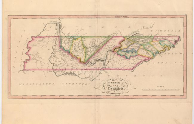
Subject: Tennessee
Period: 1818 (published)
Publication: General Atlas
Color: Hand Color
Size:
20.5 x 9.8 inches
52.1 x 24.9 cm
This fine map of Tennessee shows the state at an early point in its development with only twelve organized counties in the Mero and Washington Districts. The majority of the state is shown to be Cherokee tribal territory. The map depicts a few settlements, forts, trails, and roads, two of which venture out into Cherokee country to the Tennessee River.
Mathew Carey was a seminal figure in early American publishing; establishing the first publishing firm to specialize in cartography and issuing the first atlas devoted exclusively to American maps. He set up an elaborate cottage system of craftsmen for compiling, engraving, printing, and coloring maps. This practice was emulated by later American cartographic publishers such as John Melish and Henry S. Tanner.
References:
Condition: A
Original color and wide original margins. There is a bit of light soil in the map and margins and a short bottom fold separation well away from map.