Subject: Hawaii
Period: 1901 (dated)
Publication:
Color: Printed Color
Size:
31 x 36 inches
78.7 x 91.4 cm
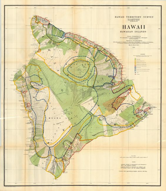
This large and beautifully lithographed map was surveyed by W.D. Alexander and Walter E. Wall. It provides terrific detail at a scale of about 3 miles per inch. Virtually the entire island is ringed with roughly 400 strips of land with the owner's name recorded. These lots are locally called ahupua'a and are the basic land division in Hawaii. They usually run from the ocean to the mountains, as can be seen here. Contour lines are drawn in red at 300 ft. intervals . Extensive legend uses color and line to delineate the approximate area of Public Lands, Homestead Settlements Tracts, Grazing Lands, Pineapple Lands, Sugar Plantations, Forest Reserves, and wet lands consisting of rice and taro. Schools and post offices are shown by colored circles. The primary triangulation was accomplished by Alexander, C.J. Lyons, J.S. Emerson, J.M Lydgate and E.D. Baldwin. A very handsome and uncommon chart of the island.
References:
Condition: A
Folding, as issued. Small marginal binding tear just touching neatline, professionally closed. Apart from a little fold toning and one very small intersection split, a fine and bright example.