Subject: Florida
Period: 1859 (dated)
Publication: Sen. Ex. Doc. No. 2, 1st Session, 36th Congress
Color: Black & White
Size:
24.3 x 23.5 inches
61.7 x 59.7 cm
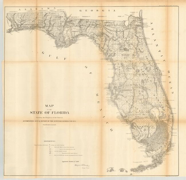
This state survey map is drawn on a scale of 18 miles to the inch. It shows the topography, vegetation, towns, cities, forts, rivers, lakes, swamps and many early trails and roads. Most of the state is shown as surveyed with a key designating the extent or the work completed. Area extends to show the keys and to Dry Tortugas Island and Ft. Jefferson, and locates Ft. Lauderdale, Boca Rabones, Key Biscayne, scores of smaller keys and much, much more. It is signed in the plate by Francis L. Darcy, Surveyor General.
References:
Condition: B
Sharp impression with folds as issued. There is light toning along folds and a few small fold separations, as is common with these types of maps. Left binding side and bottom margins are close but still sufficient for framing.